Cultivating geospatial awareness in an organization could be a tricky task, depending who you ask. One of the most simple tactics to use – provide as many tools as you can with a geographical component inside, and then educate end-users about how to use those tools to their full potential.
Most of the final product is exported in PDF format. Even if people don’t have full Adobe Acrobat DC version, they might have Adobe Reader or any PDF alternatives that closely resemble functionalities of the full PDF.
Don’t miss out on the opportunity to give your end-users yet another tool they can use to get coordinates or measurements from. In fact, GIS products and PDF functionalities have been in synergy for a number of years now. However, as I am noticing, not all end-users of PDF know of its full potential.
So, here is how it works. In fact, the process is extremely simple:
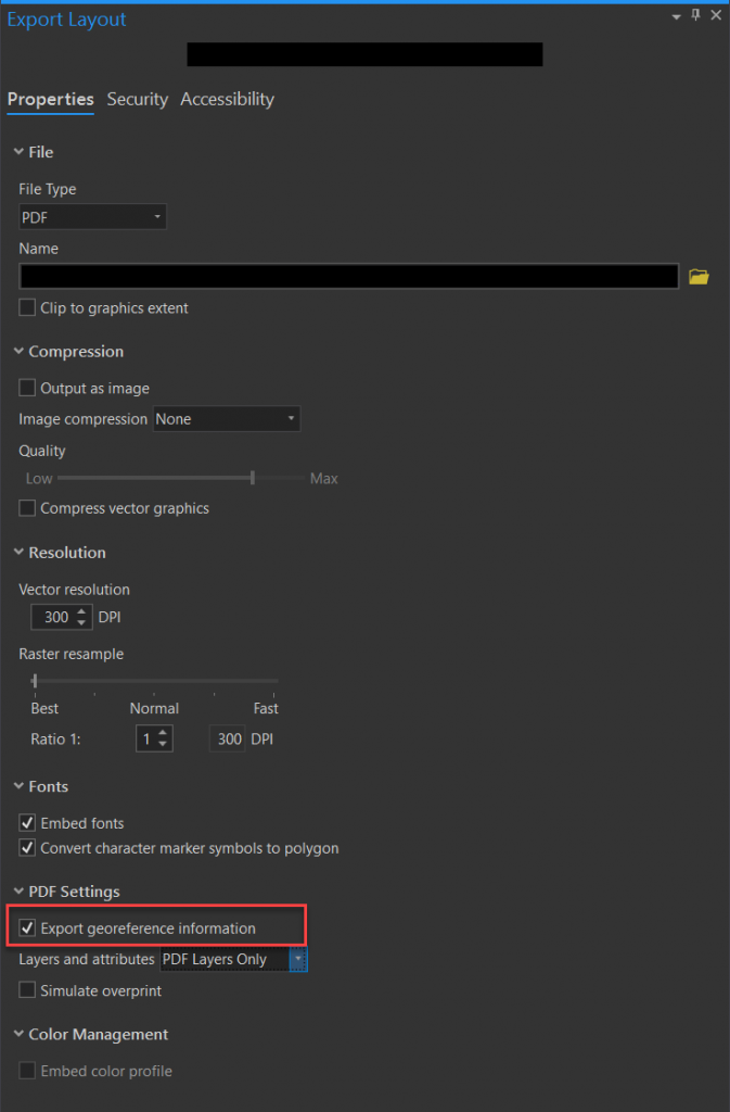
Step 1 – Export GIS Layout into PDF format with “Export georeference information” checked
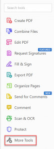
Step 2 – Open file in Adobe Acrobat DC, expand tools on the right-side of the screen, located “More Tools”.
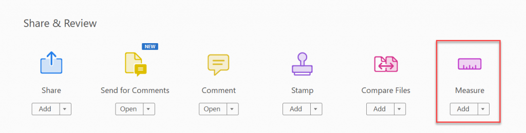
Find “Measure” tool under Share & Review category
When a tool is activated, it’s functions will show up at the top of the screen as a new toolbar

- Measuring Tool – allows to measure distances and angles between points
- Geospatial Location Tool – allows to see Latitude and Longitude coordinates in decimal degree format.
Pretty simple, right? This is just another way to allow your end-users to gain autonomy with basic tasks like distances or coordinates.