Quick notes on how to look for Sentinel imagery. I prefer Sentinel for it’s 10-meter resolution, which begins to look pretty good at 1:15,000 scale. Four cases have emerged, and each one is used on case-by-case basis.
Case 1 – Copernicus Hub
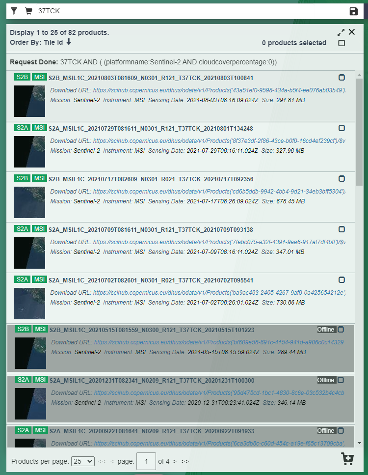
Using Copernicus Hub. In this case imagery would be presented for download. This is my least favorite option as I find the interface to be least intuitive for a simple end-user. I do sense (however personally still unconfirmed) that the search at Copernicus turns out the largest number of results.
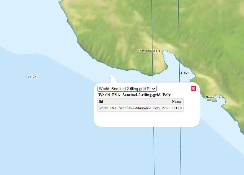
- First obtain tile reference here (this location is hosting for Sentinel 2) – Maps (eatlas.org.au). Zoom to area of interest to locate tile Name.
- Sign in to Copernicus here – https://scihub.copernicus.eu/dhus/#/home. Create an account to sing in if necessary;
- Tile name could be directly injected into the search box. Located the date if interest to download
Case 2 – EOS
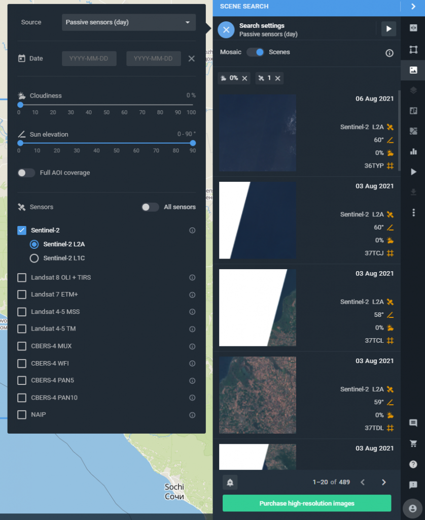
Using EOS (Earth Observation System) viewer.
EOS allows to look up assorted imagery and the list could be found here – Sentinel-2: Satellite Imagery, Overview, And Characteristics (eos.com)
I do appreciate slick control panel which allows to pick cloud coverage. Drawing your own AOI is a nice touch too. Note, how you can still identify tile names.
When trying to load tile into the base map to view, EOS asks to sign in. I had to create a new account. Luckily, using Google, LinkedIn or Facebook is offered.
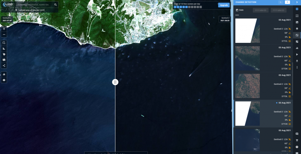
Another nice feature of the Viewer is the ability to compare images from different dates. This is every historian’s dream tool – a highly useful feature when evaluating area development over time.
It seems there are few options from here:
Option 1 – Download using download button on the right-side panel.
Option 2 – Purchase high resolution imagery. I have not tested this option to describe the experience;
Option 3 – Add data to WMS.
This feature appears to be available under a paid plan. As tempted as I am to drop a screen-shot for those plans (since I failed to find a direct link and had to run thru the full process), I will just reserve to describing only.
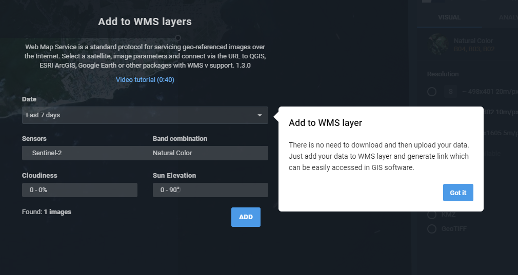
Three available plans are Basic, Pro and Enterprise. WMS is available under Pro plan, as well as unlimited image viewing per day, unlimited band combinations, unlimited downloads, larger size jpegs, and some more. Basic plan allows up to 10 downloads and 10 views per day with smaller sized jpegs only. Enterprise plan is pretty much self-explanatory – multiple users access and you need to contacts admins of the website for additional information.
Since for now all I need is to view the area, I will forgo payment plans.
Case 3 – Earth Explorer
(update 09-19-2022: decommissioning notice posted by USGS about Sentinel archives being discontinued before the end of the year. Recommended to go to Open Access Hub (copernicus.eu))
Using EarthExplorer by USGS. Sign in is required. Make sure to login first before starting the search and the download. This viewer I have used for years and I greatly appreciate the SGS effort to bring different data together and make it publicly available without charging for it.
Control panel is not as slick or fancy as in EOS Viewer, but it is intuitive and is easy to use. Generally, I start by zooming in on an area of interest and using “Use Map” option to define AOI.
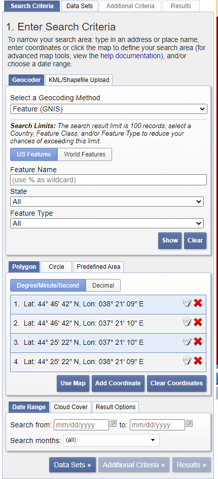
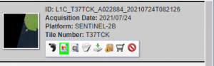
Specify date range and cloud coverage type if necessary. Switch to Data Sets tab to pick type of the imagery for download. Click Results to view available tiles. Each displayed tile could be previewed by clicking preview button underneath. In the same toolbar you can find download button.
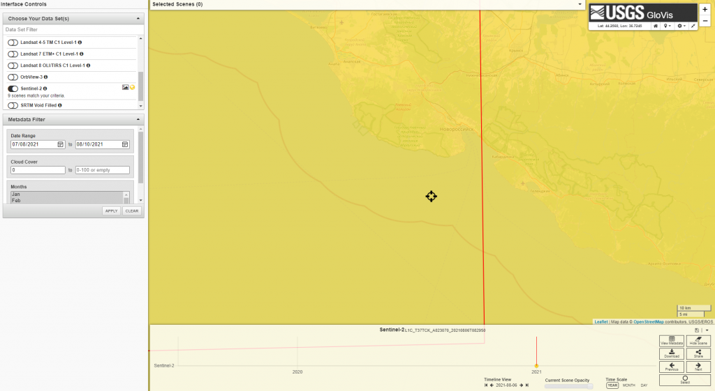
Case 4 – Glovis
Using Glovis (USGS).
Sign in is required. There is a certain similarity in the feel of Glovis and the EarthExplorer since both are done by the USGS. The differences are in the number and types of the data offered, and the interface (primarily how search results are presented).
What I like about Glovis is the timeline and the interactive change of tiles instantly loaded to preview the data. This is also the feature that makes me go back to EarthExplorer and view the list of tiles from there.
Sometimes the problem with Glovis is this: if you are looking to download two adjacent tiles, dynamic change might produce tiles too far apart in dates, and you can’t see several tiles at once. That is where you have to move around the map or the timeline bar to catch exact date and coverage. In contrast, the EarthExplorer gives fixed tile footprints to choose from to download.
Case 5 – Sentinel Hub
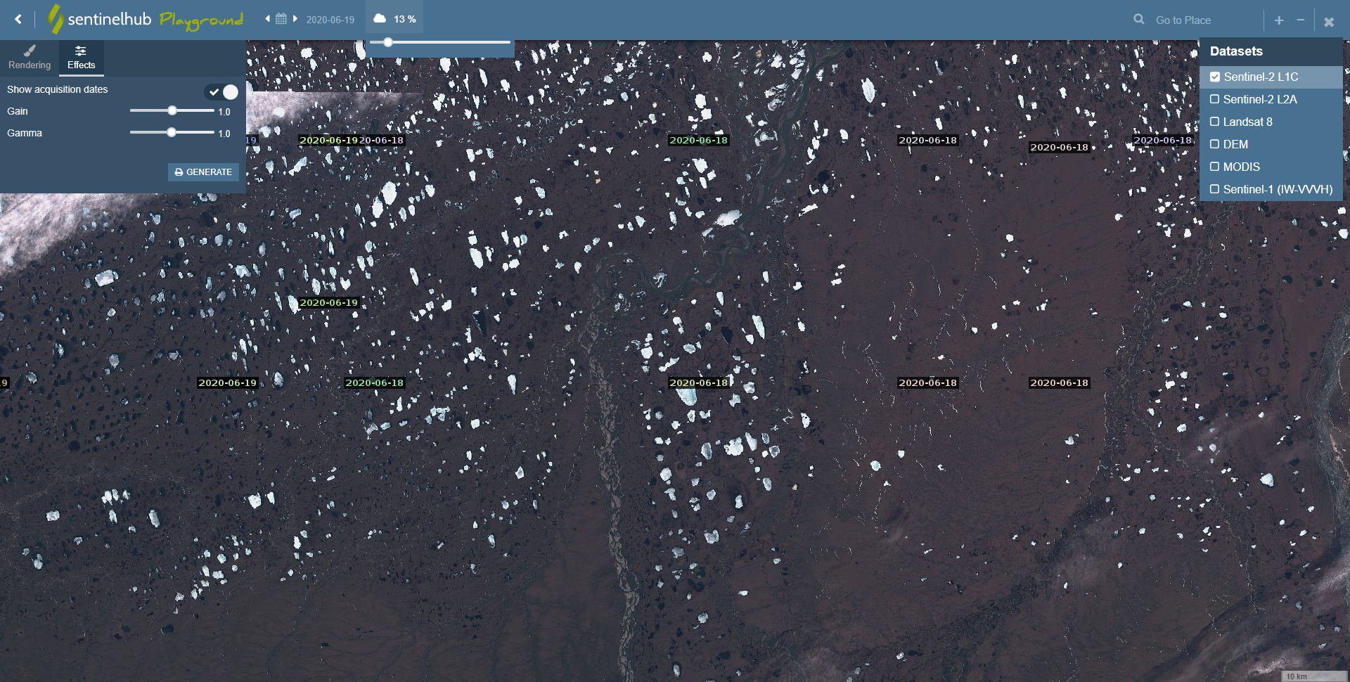
Option 1 – Sentinel Playground
Sentinel Playground – interactive online experience provided by Sentinel Hub with ability to review dated and cloud coverage on those dates. A bit glitchy in my Edge browser as the imagery does not seem to change when I scroll thru a super nice calendar feature., but it is a minor inconvenience as I would proposed this work around: under effect turn on acquisition date and zoom in/out for imagery to refresh.
Overall this is a super easy tool to use which allows to view Sentinel 1 and 2, MODIS, LandSat 8 and DEM for places around the world.
Sentinel Hub itself provides a variety of interesting service. Here is quick link to their brochure. Registration required.
As far as the download goes from this viewer, it basically allows to take a screen shot of what is shown.
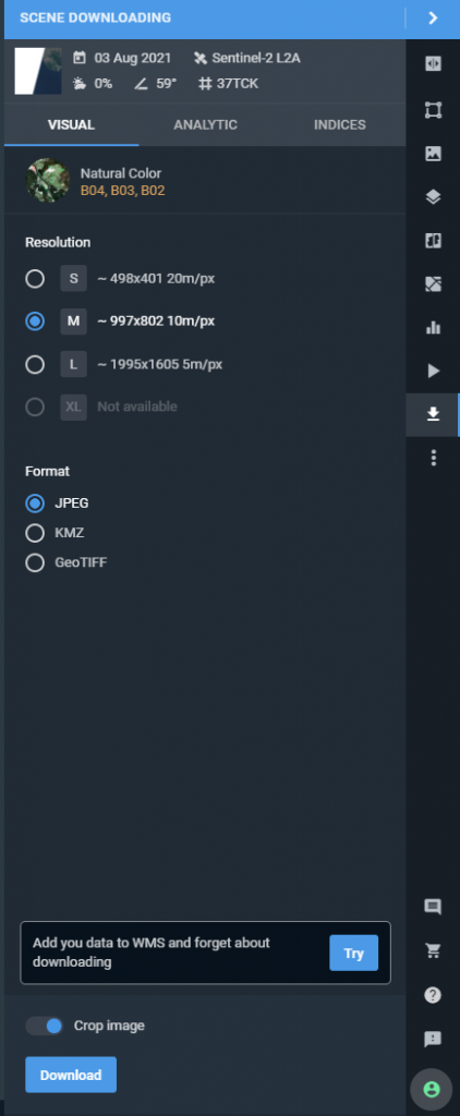
Option 2 – Sentinel Hub EO Browser
Same location, registration is requred, but a very nice viewer with better download and visualization options.
Sentinel Hub EO Browser (sentinel-hub.com)
- Select imagery of interest
- Scroll to the bottom of the list to specify date ranges. Click “Search”
- Generated results provide footprints’ list sorted by date. Click on a thumbnail in the list to see the actual imagery
- As the imagery is loaded into the map view, Visualize tab is available in the left-hand side to pick imagery settings
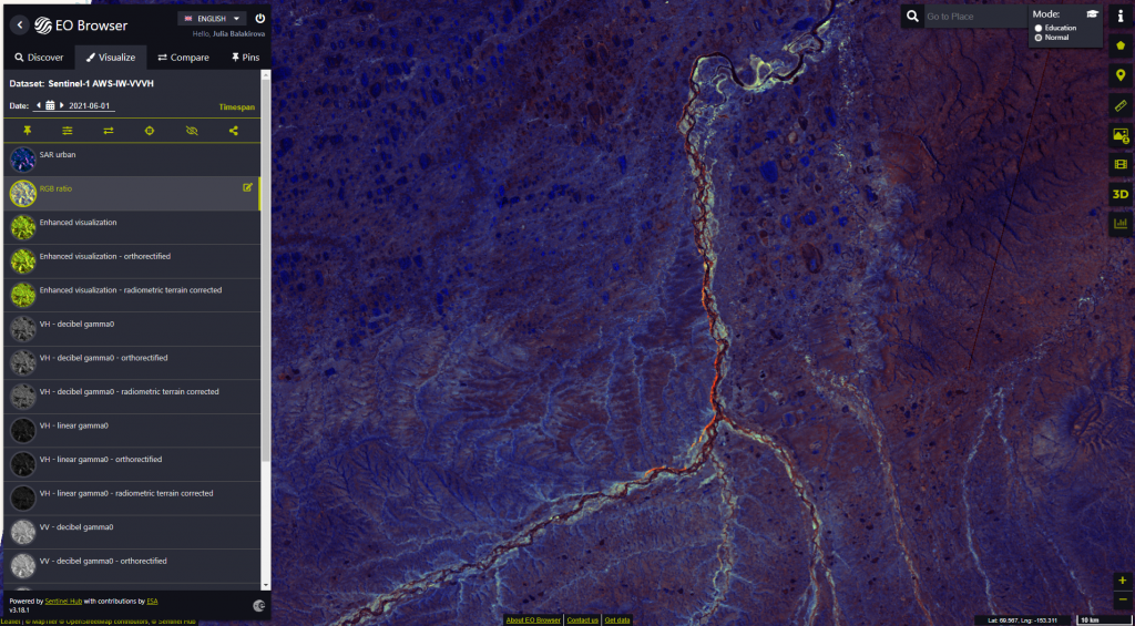
The most fun about the EO Browser is the ability to create time laps animation and download it. Downloads are in a GIF format.