This section are cliff notes collecting and condensing information from different sources. See this post about how to search for Sentinel – Searching for Sentinel imagery – Baseline GIS There are several types of satellite imagery available to users. Aspects of the data collection very often come into play when discussing the quality of an … Read More
Showing all posts tagged sentinel
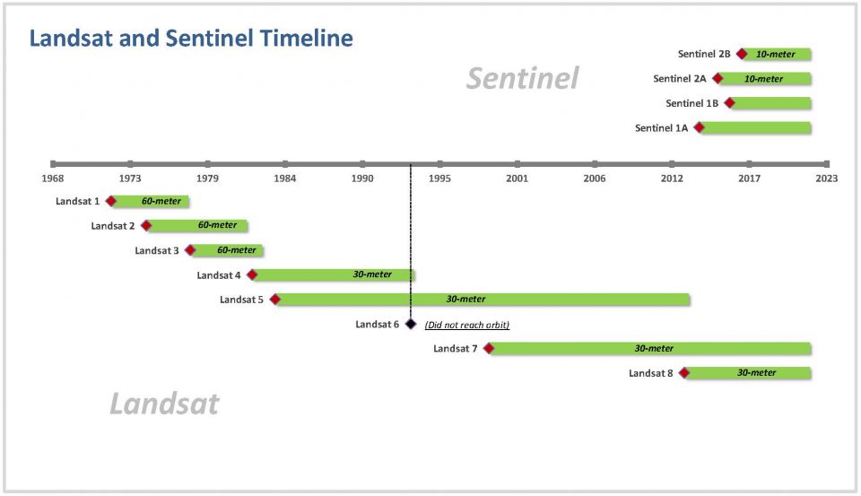
Satellites Timeline

Notes on chronology of satellite programs
Searching for Sentinel imagery
Satellite imagery is a powerful tool for any industry. Sentinel imagery is relatively recent program, with images produced at a higher resolution. Have you tried looking up available imagery? Here are four ways to do so….
