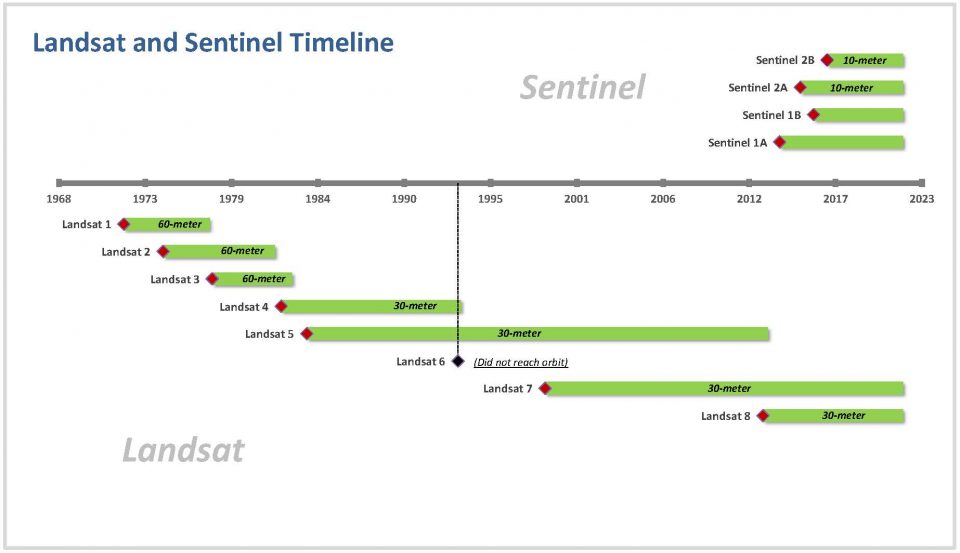
When searching for historical imagery, it is important to understand how and when satellites were in the orbit. That is just without knowing anything about specs of each program.
Generally I use Landsat and Sentinel imagery. This page shows comparative chronology between Landsat and Sentinel programs.
Sources:
- EOS blog – Historical Satellite Images To Get Insights From The Past (eos.com)
- The European Space Agency – ESA – The Sentinel missions
- USGS Landsat descriptions – Landsat Satellite Missions (usgs.gov)
- Landsat progarm – (Wikipedia)

