As I have explored in here – Earliest Maps found in China – earliest physical maps found in China date back to the 2nd century BC. The Kuan-tzu document attributed to the 7th century BC is reported to contain fragments of a chapter on maps.
Outside the Silk Land, older map-like images have been found in Italy (Bedolina Petroglyph – c.1500 BC) and in the former Babylonian Kingdom territory (Babylonian World Map – c.750-c.500 BC).
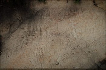
Bedolina Petroglyph
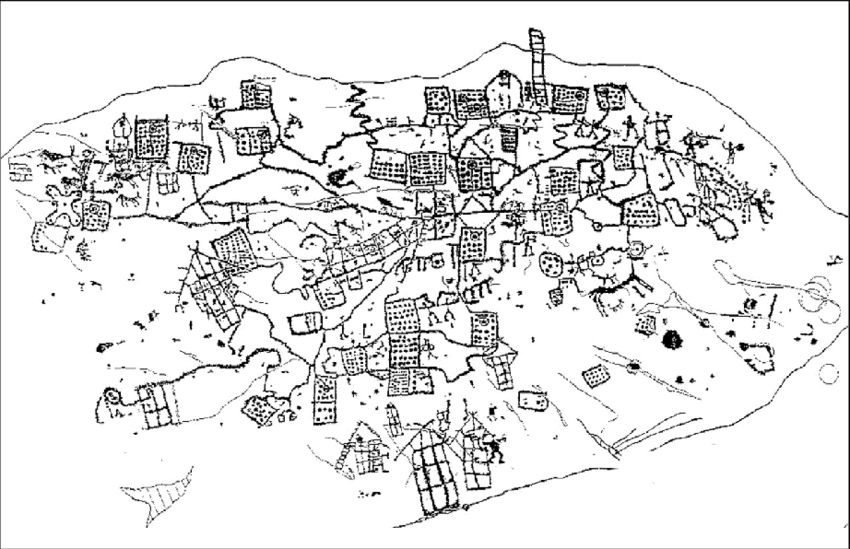
Bedolina Map tracing (Wikipedia)
Bedolina petroglyph is part of the large petroglyph complex located in the Province of Brescia, north Italy. The rock measures about 9 x 4.3 m and the engraved area measures about 4.3 x 2.4 m.
The imagery was produced by members of an early Iron Age agricultural community. Total of 109 shapes have been identified. This prehistoric rock is interpreted as the depiction of cultivated plots, mountain paths and villages. Some shapes are even interpreted as livestock.
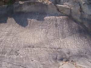
Bedolina rock (see original in Wikimedia). Dotted squares are interpreted as fields suggesting emerging land tenure system.
.jpg)
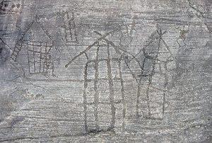
Houses on Bedolina rock, appear to be a later addition carved using metal tools and not part of the main composition.
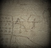
Human figures could be recognized in several locations carved into the Bedolina rock. It is assumed that those were added in later centuries.
Sources:
- Bedolina Map – Wikipedia
- The Bedolina Map – an Exploratory Network Analysis by Craig Alexander
- TRACCEThe map of Bedolina, Valcamonica Rock Art – TRACCE (rupestre.net)
- “Great Maps: The world’s masterpieces explored and explained”, Jerry Brotton (DK series, Smithsonian collection)
Babylonian World Map
Babylonian World Map is a clay tablet written in Akkadian and dated to 6th century BC. The tablet resides in the British Museum.
The world as it was understood is represented as a disk (inner circle) surrounded by the Marratu (salt sea or ocean). In the center of the circle a central compass hole is placed indicating that the Babylonian Empire was the center with everything else emanating from sacred center.
A wide polygon runs down thru the central circle and is identified as the river Euphrates. Upper horizontal polygon represents Babylon. It is surrounded by cities and mountain ranges. The tablet depicts number of ancient cities, regions, kingdoms and countries such as Assyria, Urartu, Susa and Chaldea. Total of seven small circles could be identified representing seven cities.
Outer regions, representing the limits of the Babylonian world, were depicted as triangles. They were described as dangerous off-limits places full of scary beasts.
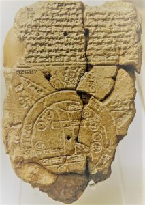
Babylonian tablet
Sources:
- Babylonian Map of the World – Wikipedia
- tablet | British Museum
- “Great Maps: The world’s masterpieces explored and explained”, Jerry Brotton (DK series, Smithsonian collection)