This section are cliff notes collecting and condensing information from different sources. See this post about how to search for Sentinel – Searching for Sentinel imagery – Baseline GIS
There are several types of satellite imagery available to users. Aspects of the data collection very often come into play when discussing the quality of an imagery such as a resolution, cloud coverage, path of flight etc. So, what are things to remember?
About Most Common Types of Satellite Imagery
- Pleiades – constellation of two very high resolution (50-cm) satellites. This is another program run by the European Space Agency (ESA). The coverage of the Earth surface is a repeating cycle of 26 days. The orbital plane is shared with SPOT 6 and 7, creating a larger constellation of 4 satellites with 90° spacing between. Infographic could be found here – Pleiades Anniversary_Infographic.
- Pleiades-1A – December 17, 2011
- Pleisades-1B – December 2, 2012
More about Pleiades could be found: SearchResult – Earth Online (esa.int)
Read how to access the data – Pleiades ESA archive – Earth Online. Preview available coverage through the web viewer – Ordering (intelligence-airbusds.com)
- Sentinel – European program run by Copernicus Programme and coordinated by European Commission in partnership with European Space Agency. First established in 2014. For technical guides of individual missions, visit here.
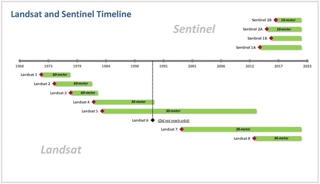
- Sentinel-1A (April 03, 2014) and Sentinel-1B (April 25, 2016) – all-weather, day and night imaging. 12-day repeat cycle;
- Sentinel-2A (June 23, 2015) and Sentinel-2B (March 3, 2017) – high resolution optical imaging. Revisit for a single satellite is 10-day, and for the constellation combo 5 days. Resolution varies between 10 to 60 meters based on the particular band ;
- Sentinel-3A (February 16, 2016) and Sentinel-3B (April 25, 2018) – global ocean and land monitoring. Full resolution is approximately 300 meters. Revisit time vary but within 2 to 4 days (at least for the ocean coverage). Several products are available ;
- Sentinel-4 – scheduled for 2023
- Sentinel-5 – launched 2021 – atmospheric composition monitoring;
- Sentinel-6A (November 2020) and Sentinel-6B (scheduled for launch in 2025) – high precision altimetry sea level measurements;
- MODIS – is an instrument installed on two satellites operated by NASA – Terra and Aqua,both are part of the NASA Earth Observation System (EOS):
- LandSat – United States joined NASA/USGS program running since 1972 when the Earth Resources Technology Satellite was launched (July 1972).
- Landsat 1 – July 23, 1972 – January 6, 1978
- Landsat 2 – January 22, 1975 – February 25, 1982
- Landsat 3 – March 5, 1978 – March 31, 1983
- Landsat 4 – July 16, 1982 – December 14, 1993
- Landsat 5 – March 1, 1984 – June 5, 2013
- Landsat 6 – October 5, 1993 – failed to reach orbit
- Landsat 7 – April 15, 1999 – present
- Landsat 8 – February 11, 2013 – present
- Landsat 9 – September 27, 2021 – present
Categories of Remote Sensing
- Passive – what a naked eye can see. These are passive types of generally used imagery:
- MODIS,
- Landsat 8
- Sentinel 2
- Active – a satellite generate an energy source and uses it to record reflected radiation effectively generating information about the surface of the Earth. With this type, the time of day, or seasons do not matter.
- LIDAR is one good example here where surface elevations information coould be collected less dependent of field conditions.
- Sentinel 1 – active type of sensor from the SAR (or Synthetic Aperture Radar) type.
A very clever explanation for what the SAR is could be found here. Important to note is that the resolution varies based on the properties of wavelength. And, even more important is that all comlexities of collection and processing aside, for the end user this type of data is not impacted by the time of day, weather, or cloud coverage.
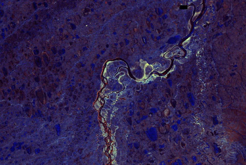
Example of Sentinel-1 (SAR) imagery taken at night and visualized with RGB ratio
Download Sources:
- LP DAAC – Search (usgs.gov) – USGS EarthData Catalog
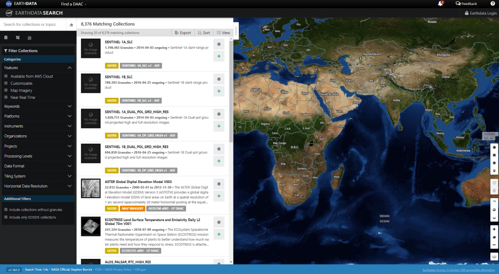
- Earthdata Search (nasa.gov) – Web Viewer for EarthData
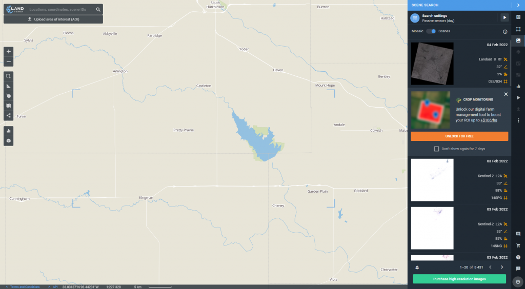
- EOS Land Viewer – Web Viewer to search Sentinel, MODIS, LandSat etc, or search by sensor types such as passive, active, terrain tiles etc.
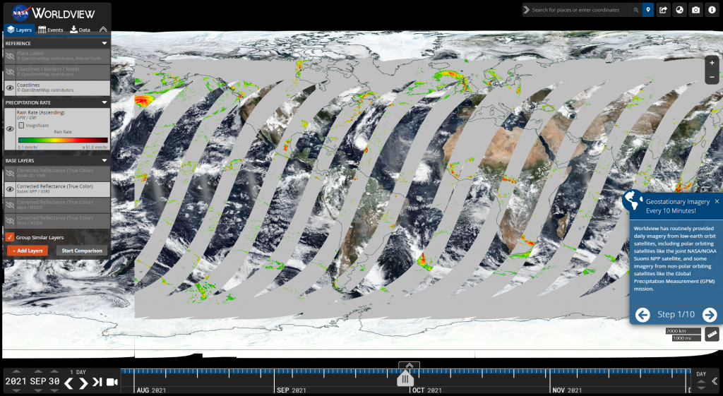
- EOSDIS Worldview (nasa.gov) – Web Viewer providing access to global satellite imagery
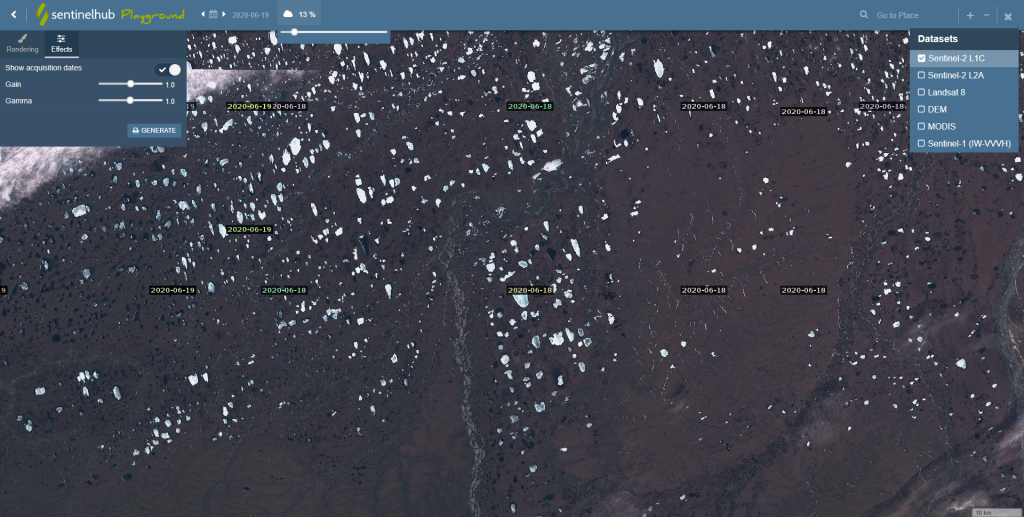
- Sentinel Playground | Sentinel Hub (sentinel-hub.com) – Web Viewer provided by Sentinel Hub. Provide ability to search for avalable imagery, but the download option only allows to basically take a screen shot and download it.
-
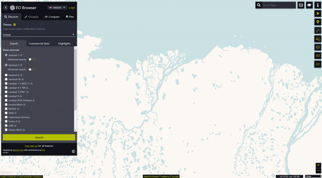
- Sentinel Hub EO Browser – from the same source as the Sentinel Playground, this slick Web Viewer provides search capabilties for assorted type of imagery, particularly notable – Sentinel 1. To specify date range, scroll to the bottom of the imagery list.
- In order to download for use in GIS application environment, switch to Analytical Tab in the download and select appropriate format.
- Sentinel Hub EO Browser – from the same source as the Sentinel Playground, this slick Web Viewer provides search capabilties for assorted type of imagery, particularly notable – Sentinel 1. To specify date range, scroll to the bottom of the imagery list.
-
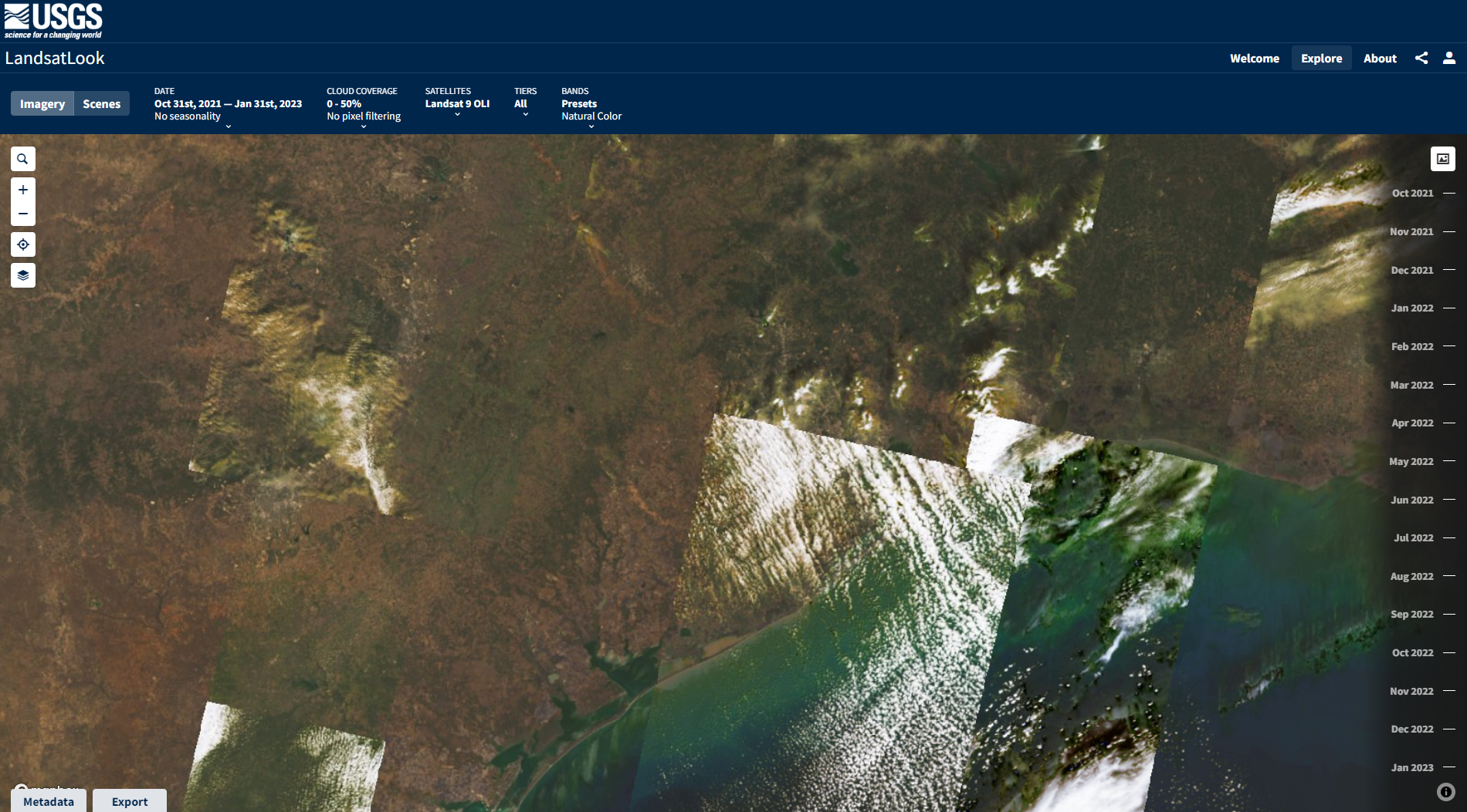
- USGS LandsatLook – This one is a quick viewer for available Landsat imagery
References:
- Raster file formats—ArcGIS Pro | Documentation
- What is Synthetic Aperture Radar? | Earthdata (nasa.gov)
- Satellite Imagery: Active sensors (Sentinel-1) – Things To Luc At
- What is Synthetic Aperture Radar (SAR)? – Pathfinder Radar ISR & SAR Systems (sandia.gov)
- Copernicus Programme – Wikipedia
- Homepage | Copernicus
- Moderate Resolution Imaging Spectroradiometer – Wikipedia
- Geospatial Data Analytics, GIS Software, Satellite Imagery In EOS
- Sentinel Online – ESA – Sentinel Online
- Landsat program – Wikipedia
- Landsat Timeline | Landsat Science (nasa.gov)
- Pléiades (satellite) – Wikipedia
- Missions – Earth Online (esa.int)
- USGS EROS Archive – Sentinel-2 – Comparison of Sentinel-2 and Landsat | U.S. Geological Survey
- Pleiades | Pleiades (cnes.fr)
- 15 Free Satellite Imagery Data Sources – GIS Geography