Very often a request might come in to provide one imagery type or another in specific formats. Very frequent, requests like this are associated with getting data from one environment to another. Here are some “cliff notes” collected on what is supported by ESRI software.
Raster comes in two general types: discrete and continuous. More here.
Single-band, multi-band, mosaic dataset – here is a breakdown on rendering – Raster rendering behavior—Help | ArcGIS for Desktop
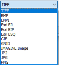
Export options presented by ArcMap (10.8.1) when exporting data by right-clicking on an image loaded into a map.
For organizing multiband data:
- ESRI BIL – Band interleaved by line
- ESRI BIP – Band interleaved by pixel
- ESRI BSQ – Band sequential
More details here: BIL, BIP, and BSQ raster files—Help | ArcGIS for Desktop
TIFF, GIF, BMP, JPG and PNG – most basic raster file formats:
These three are grouped together simply because they are the most recognizable formats in the graphics world. In GIS they are also supported formats for exporting maps. More on that here: Exporting your map—Help | ArcGIS Desktop
- TIFF /GeoTiff – (Tagged Image File Format) – Developed for aerial and satellite imagery, this a widely used format also spanning into other kinds of data such as Digital Elevation Model (DEM) data, and Digital Ortho Quadrangle data. Note here that a number of non-geospatial platforms (with geo-spatial capabilities enabled or integrated) do not accept .tif format.
More on TIFFs:
- formats available (edina.ac.uk)
- What is a GeoTIFF? – GIS Lounge
- GeoTIFF – A standard image file format for GIS applications – Geospatial World
- GeoTIFF | Earthdata (nasa.gov)
- GIF – (Graphic Interchange Format) – generally a low resolution file for images with reduced numbers of colors;
- PNG
- BMP
- JPG