Very simple yet often needing a reminder process of extracting raster(s) to an irregular shape, and merging several images into one.
Clipping rasters to a shapefile and merging into one image
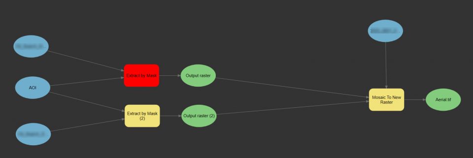
Very simple yet often needing a reminder process of extracting raster(s) to an irregular shape, and merging several images into one.
Not sure what the resolution arc is? Here are the links to explanations.
This section are cliff notes collecting and condensing information from different sources. See this post about how to search for Sentinel – Searching for Sentinel imagery – Baseline GIS There are several types of satellite imagery available to users. Aspects of the data collection very often come into play when discussing the quality of an … Read More
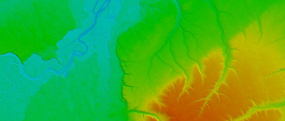
Never was DEM creation that straightforward in ArcGIS as it is in Global Mapper. And in both cases processing the data should be done carefully as to preserve elevation information in the new raster as accurate as possible. I will try to review available options. First of all, I would avoid Interpolations tools in the … Read More
General list of supported raster formats with links to more detailed sources
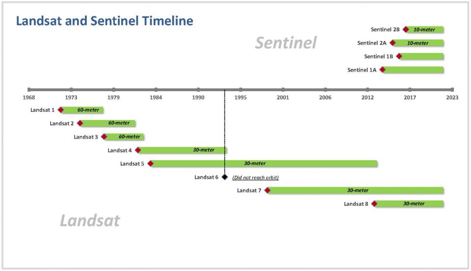
Notes on chronology of satellite programs