Not sure what the resolution arc is? Here are the links to explanations.
Raster Resolutions
Not sure what the resolution arc is? Here are the links to explanations.
General notes and collection of links related to GIS-CAD integration
This section are cliff notes collecting and condensing information from different sources. See this post about how to search for Sentinel – Searching for Sentinel imagery – Baseline GIS There are several types of satellite imagery available to users. Aspects of the data collection very often come into play when discussing the quality of an … Read More
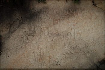
Quick description of two early maps: Petroglyph rock – Bedolina map dated to c.1500 BC, and Babylonian clay tablet dated to 6th century BC.
Description of how to move a large number of point features using distances and directions.
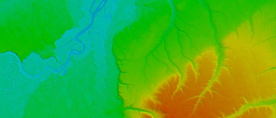
Never was DEM creation that straightforward in ArcGIS as it is in Global Mapper. And in both cases processing the data should be done carefully as to preserve elevation information in the new raster as accurate as possible. I will try to review available options. First of all, I would avoid Interpolations tools in the … Read More
Current version of ArcPro 2.8.3. If there is never enough of a base imagery, it is possible to integrate basemaps from Mapbox gallery, as I just learned. Original credit goes to this users: This article provide quick updates as I noticed that the interface in the Mapbox slightly has changed since the video was made. … Read More

This is one of those cool integrations that ESRI has been working on for some time now. Maps exported from ArcPro could be exported in .aix format. AIX stands for Adobe Illustrator Exchange. More here – Use .aix files from ArcGIS Pro—ArcGIS Maps for Adobe Creative Cloud | Documentation. Here is a forum discussion dedicated … Read More

quick notes on when Enable Sync should be applied to layers published into ArcGIS Portal or ArcGIS Online
General notes on observations related to renaming features published into GIS Portal